Mobility (in)justice atlas (Nov. 23)

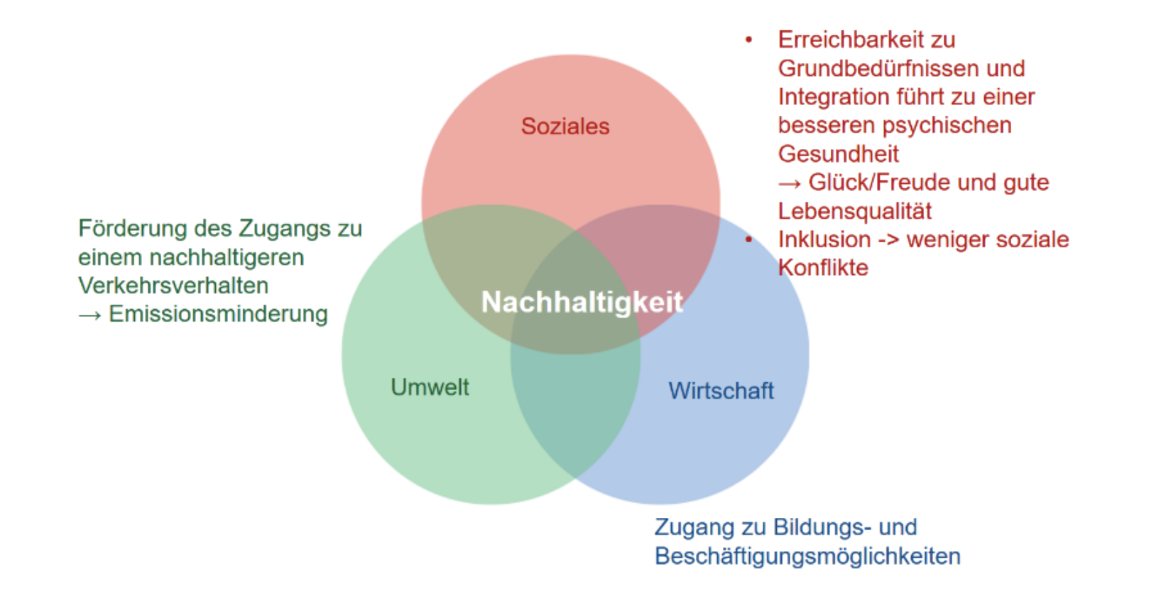
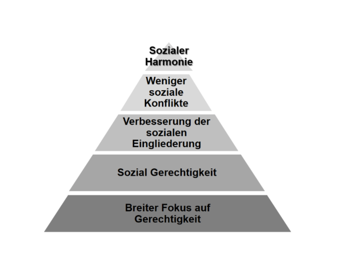
Why mobility justice?

A broad focus on equity promotes social equality, inclusion and reduces conflicts for social harmony. Mobility equity increases acceptance and support for projects. It is crucial for sustainable development as it increases the use of active transportation and reduces emissions. Fair accessibility improves educational and work skills and fulfills basic needs, leading to higher quality of life and satisfaction.

Click here for the mobility (in)justice atlas


Why an atlas?
Maps play an important role in policy and decision making as they provide clear and transparent indicators, visualize disparities and show complex spatial relationships. The use of maps promotes active stakeholder participation and optimizes policy making for a sustainable and equitable society.

Why a mobility (in)justice atlas?
To combat mobility inequalities, the first step is to identify them. The Mobility (In)Equity Atlas aims to highlight the most critical areas of transportation poverty where socially disadvantaged groups live in transport-deprived areas.

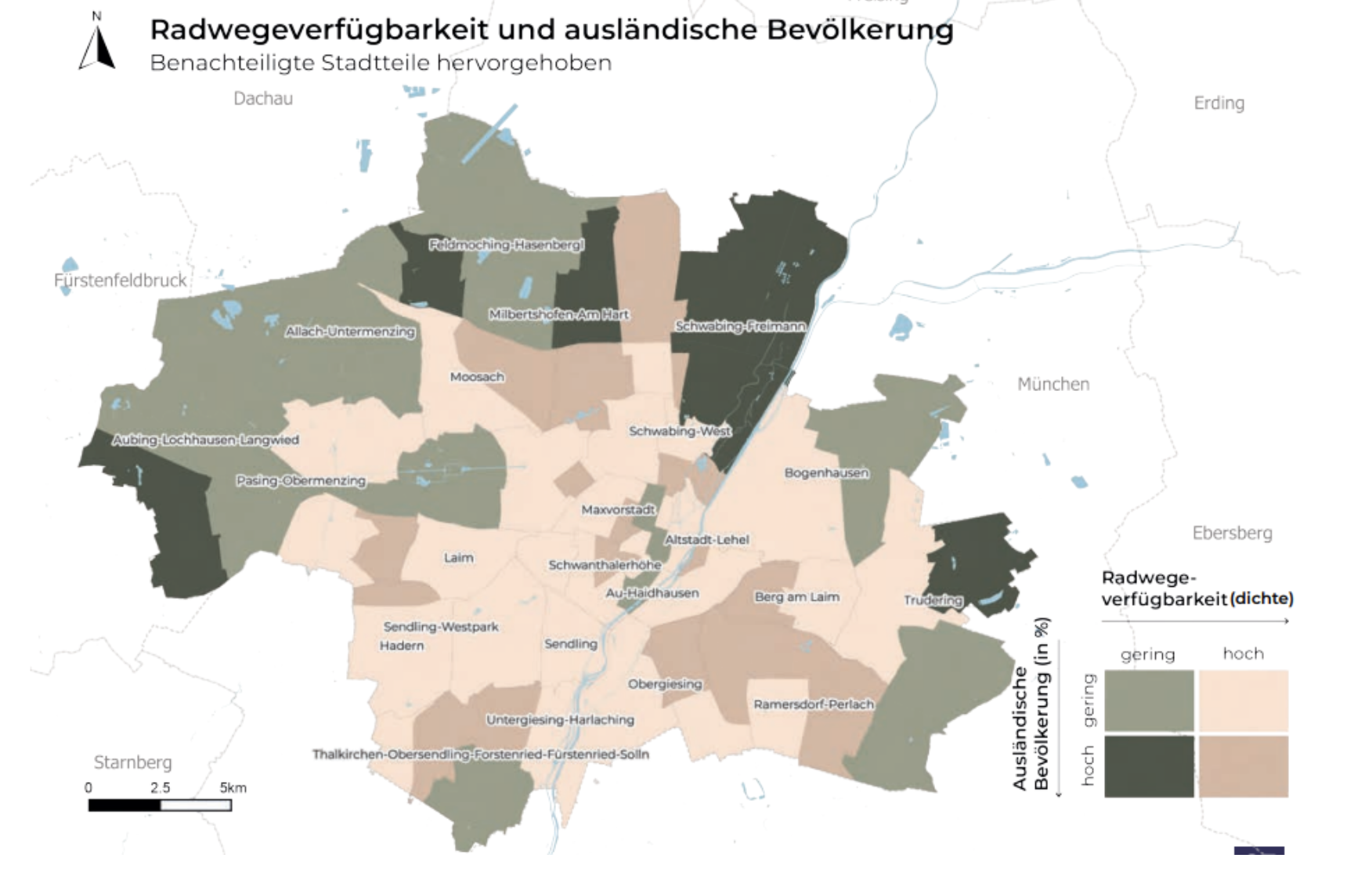
What is shown in the atlas?
There are several criteria for social and transportation disadvantage. To select the most representative categories, we conducted a workshop attended by representatives from academia, government, practitioners and institutions representing minorities.

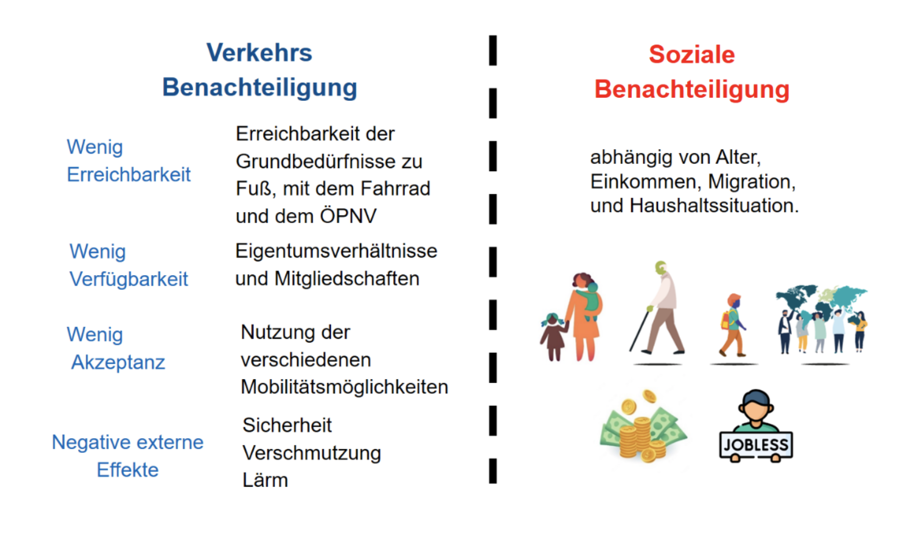
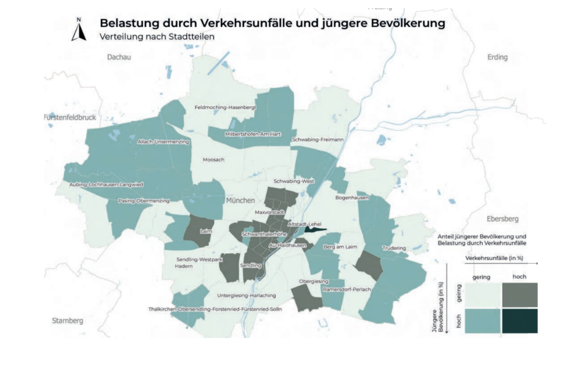
The atlas will show combinations of categories, for example: low accessibility where older people live, low availability where migrants live, a high number of accidents where families with children live.

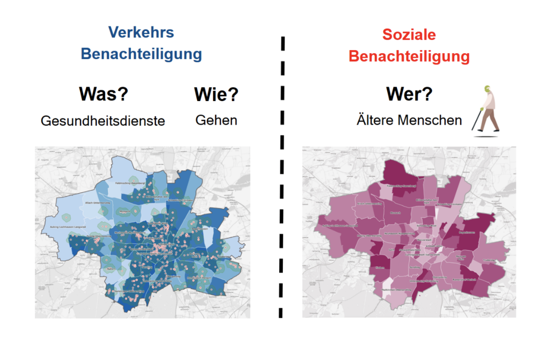
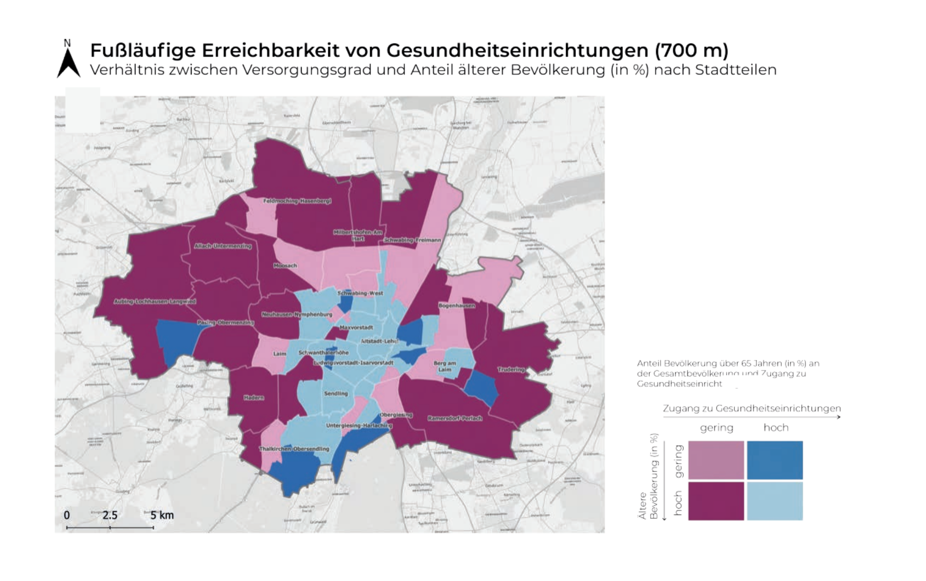
Accessibility Example: Low appreciation of accessibility to health services and where older people live

Bildschirmfoto 2023-11-13 um 21.55.42
Negative Effekte Beispiel: Verkehrsunfälle und Jüngere Bevölkerung 
Verfügbarkeit Beispiel: Radwegverfügbarkeit und Ausländische Bevölkerung 


How do you use the atlas?
To summarize, you can check the table for critical values where the values are closer to -100; the closer they are to -100, the more critical the relationship is in Munich (step 1). If you find a relationship, you can check it in the summary table (step 2) and finally search for the required map (step 3).

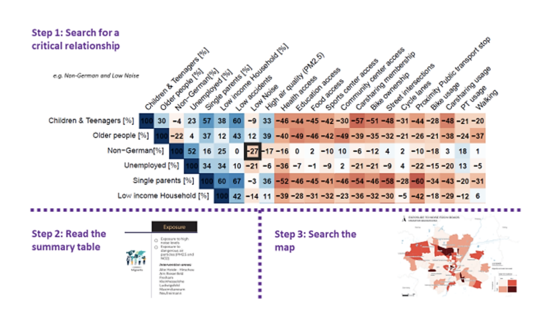
We also show some examples of neighborhood summaries in a radar plot, for example Berg am Laim Ost.

A summary map is provided on which all socially disadvantaged groups and the transport disadvantages are overlaid.

The lessons learned from the first MCube funding phase show which factors really drive projects forward - and where typical barriers arise.

Creating transparency, proving impact, sharpening strategies - the new indicator guide supports precisely this.

For the first time in this format, students made their way to three European cities. They went to Stockholm, Tallinn/Helsinki and Barcelona.

This time, mobility in the cities of Ljubljana, Genoa and Utrecht was examined.

How can mobility data and simulations make cities more liveable - and change visible and tangible?

What do Brussels, Lisbon, Milan and Paris have in common?

Where to put cars, bicycles and e-scooters - and how do we organize parking space fairly, efficiently and sustainably?

The Mobi-Score - The hidden costs of mobility at a glance

Resilient change towards sustainable mobility - lessons for a transformative urban mobility policy

Experimenting for the mobility transition - impetus for municipalities to dealing with real-world laboratories

Easy language

What is MOSAIQ?
Imagine something: There is more space for people. The streets have more trees and plants. Everyone can get around better. That's how your Schwabing-West district could be in the future. How would you like your district to be? We want to talk to you about it!

The project is called MOSAIQ. MOSAIQ is a research∙project. MOSAIQ means: Mobility and urban climate in the future city∙part. The Technical University of Munich is leading the project.

What is MOSAIQ about?
MOSAIQ wants to make the streets in the city∙part more beautiful. People should feel comfortable there. There should be more space. For meetings and plants, for example. You can help decide what is tried out in the Stadt∙teil. The ideas come from you. Some ideas will be tried out on the streets for a certain period of time.
The aim of MOSAIQ is to make urban districts good places to live.
At the same time, the climate in the city should improve. And people should be able to move around the city easily. 

What is happening in the district?

  • In the year 2025:
    The people in the district can participate. They can express their ideas. There are discussions, surveys and meetings. Researchers are also starting their work.
  • In the year 2026:
    Some ideas are tried out.
    They are moved around the streets for a certain period of time.
  • In the year 2027:
    The results are evaluated.
    Consideration is given to how things can continue∙.